It was September of 2009 when I first got on the Jetfoil to Yakushima with a bunch of curry packets, a tent, and a jacket stuffed into my bag and not a clue as to what I was doing. On the way to my seat, I picked up the largest brochure with a map of Yakushima, and the first thing to catch my eye was the Ja no Guchi waterfall.
Blanaphors:
Parasitic plants commonly
seen in autumn.
The hike to Ja no Guchi shares none of the fame of Shiratani's moss forests or Mt. Miyanoura's sub-alpine grandeur, but it has some good points. For one, there's no big steep elevation change, so if you've already hiked a big one, and you're looking for a low-key day for recovery, this route may fit the bill. Oh, you'll still want your hiking boots: You might even miss Jomon Sugi's staircases and boardwalks when you have to scramble over boulders at the brook adjacent to the waterfall, and there's a detour along the way that takes you over a small hill where you'll probably use your hands to pull yourself up and ease yourself down.
Onoaida Onsen
Another highlight is Onoaida Onsen, just next to the trailhead. For ¥200 you can enjoy this hot spring favored by many locals.
Charcoal making:
Wood is left in the kiln for ten days.
The forest through which the trail winds is a great example of the low-altitude broadleaf evergreen forests Yakushima's inhabitants have traditionally depended on for their daily needs. You'll even pass an old charcoal kiln. Keep your eyes open, and you may spot plants including orchids and balanaphors. There are also quite a few streams along the way, but don't expect them to be as pristine as water bubbling up in Yakushima's mountainous interior. The trail is a bit unclear in places where it has been eroded by typhoons or where trees have fallen down, so you'll also want to keep your eyes on those pink tape ribbons so you don't get lost!
When you get to the open shelter at the fork, make sure to turn left instead of heading up into the mountainous interior. No matter what the Lonely Planet says, that's a long, long hike better attempted in the reverse direction. Needless to say, that's exactly the route I decided to do on my first oh-so-clueless visit to Yakushima, and while I had a good time and I came out alive, I highly encourage everyone to plan a little bit better than me.
After the fork, there are a couple beautiful little river that you'll cross. (Oh yeah I wouldn't recommend this trail in bad weather, because you'll have to turn back if they are overflowing.)
And shortly after that you'll reach the destination. Hopefully you've brought lunch!
Final Elevation: ~500m Trail Head Elevation: ~100m Map time: 3.5 hours (About 7.5 km) round trip. I recommend 4 hours for this trip. Bus stop: Onoaida (Follow the signs to Onoaida Onsen)
You just couldn't ask for a better monolith than Tachuu Dake's 40 m celestial pillar.
"You don't have a rain jacket?" the young man on my left asked. There were four of us huddled under the open shelter where the route to Tachuu Dake branches off from Yakusugiland's 150-minute course.
"I've been up several times, and every time—regardless of the weather forecast—it's rained. You get used to it." I explained, "Actually, I have to wear proper rain gear when I'm working, so it's a bit of a luxury to get a little wet." And maybe if I believe it will be sunny, it will be sunny. . . right. The couple across from us dissented. They were from Okinawa, and they knew all about rain, but preferred to stay warm and dry. After all, it's a six hour round trip.
A map of Yakushima, as folks
living in Anbo see it.
「私は時々この山を登っていますが、天気予報と関係なく、毎回雨になっています。だから慣れています。実はガイドの仕事をする時、必ずちゃんとした雨具を着るので、たまに雨に濡れるのは贅沢な感じです。 沖縄の二人は雨に慣れているけど、濡れないほうが好きって。だって、太忠岳は往復5か6時間がかかるでしょう。 Tachuu Dake is easily recognizable by the large flame-shaped pier on top. This natural obelisk stands 40 m tall (according to several websites) and is visible from the town of Anbo. It speaks of Yakushima's origins as a bubble of granite that continues to rise up (1 mm every year!) as the top layers of sediment are worn away.
The celestial pillar and natural altar make Tachuu Dake an obvious destination for those seeking a spiritual journey, but the hike is also popular among hikers seeking a shorter, less crowded route than the hike to Mt. Miyanoura or Jomon Sugi. 太忠岳の山頂には安房の集落からも見える高さ40m(??)の天柱石があります。このろうそくの形になった岩はもちろん自然です。屋久島は火山ではなく、今でも浮き上がっている(年に約1mmの速さで)花崗岩のかたまりですからこそこういう不思議な岩が現ります。
Tachuu Dake is one of the traditional destinations visited on an annual pilgrimage from Anbo. Now, living in Anbo where I can see the celestial pillar, I know it's quite often, perhaps even usually, clear at the top of Tachuu Dake, but it wasn't until this past March, when I climbed it with my boyfriend, that I was finally greeted with sunshine at the peak.
Don't forget to enjoy
Yakusugiland on the way!
Entrance to Yakusugiland.
That's Tachuu Dake on the right.
太忠岳は、私の住んでいる安房の集落の前岳の一つであり、岳参りの習慣があります。安房から太忠岳の山頂にある天柱石が見えますので、山頂が曇っていない日は十分あるとわかっています。でも、今年の三月、彼氏と一緒に登った時、始めて晴れの天気で頂上に辿り着きました。 The route to Tachuu Dake begins in Yakusugiland, where you'll find a building with restrooms, a payphone, a souvenir shop, and an area where visitors can sit and eat lunch before entering the park. The entrance fee is ¥300, and you'll receive a brochure (English available) and postcard. Bring a small water bottle to fill from brooks along the way.
Just follow the signs to the
Tachuu Dake fork.
The snake-likeroots of fallen
Jamon Sugi.
Once inside Yakusugiland, you'll follow the 150-minute course around to the back of the park. Beside Yaku-sugi trees, you'll also pass stumps left over from Edo logging as you head through a mossy forest thick with spruce and fir trees and over a beautiful tributary of the Anbo River. Just before the fork to Tachuu Dake you'll see the roots of JamonSugi (Snake-Crest Sugi), which fell over in a typhoon about 15 years ago, and an open shelter with signs depicting local wildlife.
Bring a disposable toilet pack
if you want to use the only
toilet on the trail!
A grand evergreen forest!
Time for a drink!
The trail through Akahoya
is a bit washed out.
The next stop is Tenmon no Mori, a survey forest where you can sit or lay down on the benches and listen to the bird song. Look for a large sugi shortly after. This is Shaka Sugi. From here, the path gets rougher, steeper, and also muddier as you climb. There are one or two places where the red soil (Called Akahoya, this is the pyroclastic flow from a nearby volcanic eruption 7,300 years ago. ) is washed away and you'll have to use exposed roots to pull yourself up, but the trail is well marked and not highly prone to flooding.
I know you'll be tempted to
gawk at the celestial pillar,
but please watch your step
when you climb that rope!
After Tenmon no Mori and Shaka Sugi, you won't find any obvious resting points other than a huge boulder, which you will walk around one kilometer from the peak. When you reach the peak, you'll approach the celestial pillar from the back and the forest will abruptly give way to rocks. You'll carefully scramble down a short rocky drop, walk around to the front of the "alter" and climb up a rope to stand in front of the celestial pillar for a spectacular view.
. . . and you can finally relax and eat
lunch or find religion.
That lake in the distance marks
the dam where Yakushima gets its
electricity.
From here you can see the park entrance, the reservoir behind the damn on the Anbo River, and the town of Anbo in the distance. Unfortunately, there's not a view of the Interior Mountains, and you can't climb on top of the celestial pillar itself, but if you climb down from the alter and continue to walk around to the far side of the pillar, you will find the small shrine, called a hokora. Assuming the rain gods have been kind, I'll leave you alone now for a siesta. . . or to contemplate your newly found religion. . .
Peak Elevation:1497m Trail Head Elevation: ~960m Map time: 5~8 hours (About 7 km) round trip Bus stop: Yakusugiland
"Want another chocolate?" my companion called from behind. I was antsy because we'd just taken a break ten minutes back, but I couldn't complain because usually I'm the one in the back, and this time he was offering whiskey-filled chocolate from Europe. I was a bit annoyed, however, because I knew the woman in the information booth had reached the peak in 3 hours, and we'd been told it should take us two hours, but at this stop-and-go pace. . . "Unlike you, " my companion explained, "I don't have any extra fat to burn because of this diet. One chocolate gives me ten minutes of energy."
Ahem.
~~~
The trail starts where
the logging road ends.
Hasa-Dake is a half-day hike up the mountain still visited annually by pilgrims from the town of Hirauchi. It seems to me that this mountain attracts more than its fair share of beginning hikers, and hence has a rather undeserved reputation as a challenging, harry--perhaps even treacherous--peak. Anyways, there are no Yakusugi or waterfalls or moss forests, but there is a remarkable vertical distrubutiom of fora, and the view from the open peak is lovely . . . and Hirauchi also sees more fair weather than most parts of Yakushima. (Hirauchi is also known for the Youth Hostel, and a sea-side hot spring that is only usable at low tide.)
The trail is deceptively
gentle at first. . .
Map-time is about 3 hours up and 2.5 hours down, plus time to get to the trail head. Oh, to get to the trail head, you'll want to ask the locals for directions. You basically head north from the Ozaki bus stop until you get to a recently paved street, and then head up an old logging road (not the sort of road that most passenger vehicles can tolerate) on the far side of the street, but it's not marked. Eventually, the logging road reaches a river and the bridge has been long-since washed away. From here, you can follow the pink trail-marker ribbons. (Please pay attention to these; there are old trails and deer paths that lead off in other directions. . . ) I don't advise this hike to anyone not used to hiking on rugged terrain or anyone with mixed feelings about hiking up a valley of boulders and loose rocks.
Never mind the drop-off; there's a
nice view of Shichigo-Dake.
I'm not sure how safe this
would be during a storm. . .
Falling rocks?
There are also a couple areas with ropes, and one area looks a bit like a gully that might get ugly in a storm. So check the weather forecast and skip this hike if you get vertigo.
This peak has a great
on-top-of-the-world feel!
In the end, we made it up in two hours and enjoyed an overcast, but clear view from the top.
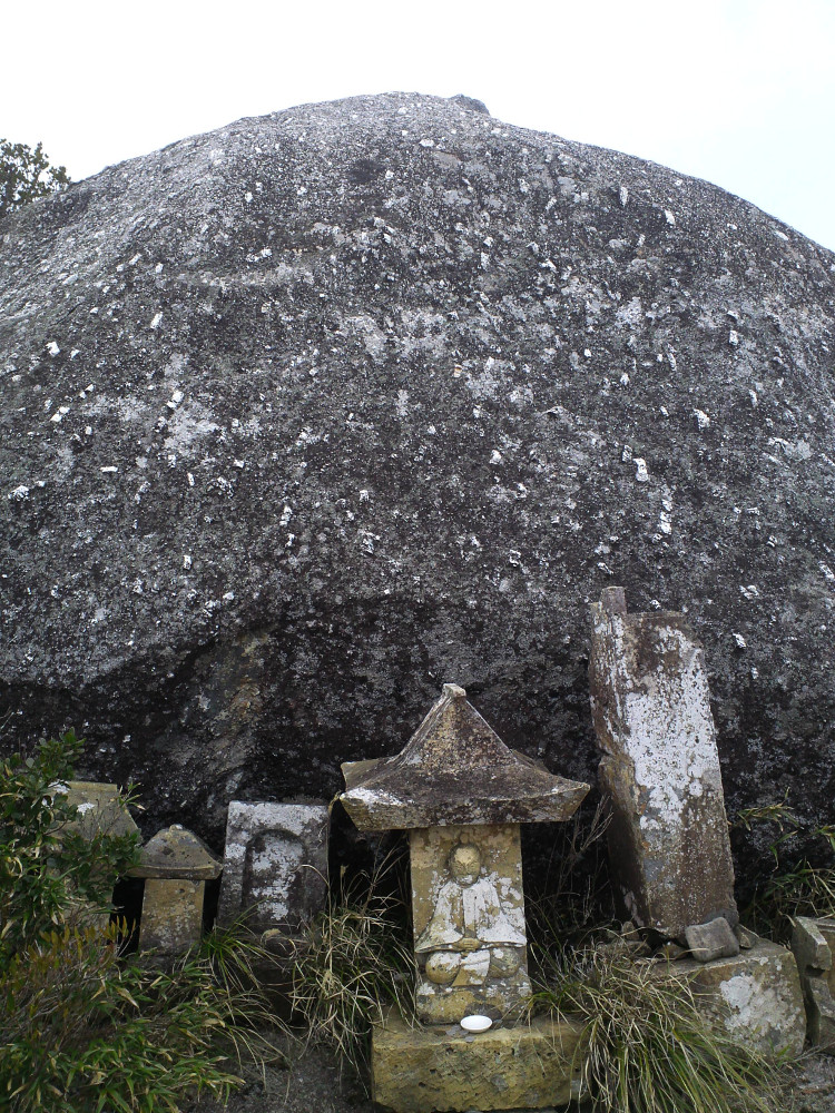
The hokora, or shrine.
I found a bit of refuge from the wind at the recess where the shrine (called a hokora) is located.
Yakushima crape myrtle
(Lagerstroemia indica)
On the way back down, we took a little time to enjoy the typical Exterior-Mountain flora, including giant crape myrtles and beautiful ferns.
photos by Mitsuhashi-san and me.
No-Hunting Area
Peak Elevation: 1259 m Trail Head Elevation: ~300 m (First 100 m or so is up an old logging road.) Map time: ~5 hours round trip Bus stop: Ozaki (Maybe about 1.5 km inland from the bus stop.) Note: The trail is well marked, but the trail head is not!
I have to apologize that I failed to record both the beginning and end of the trail. I'll have to go back!
(In the mean time, just ask at a tourist information booth for info!)
Just a few meters back it was warm and sunny . . .
(Photo by Mitsuhashi-san)
My hiking partner looked at me and said, "You're wearing jeans??"
It was a balmy day for January -- T-shirt weather -- and I'd climbed Aiko Dake before, so I answered without hesitation, "Yeah, why not? If it gets cold or rainy, I'll just head back down."
Famous Last Words in Yakushima.
On this particular day, the peak was covered in snow drifts and ice. Fortunately, we didn't need our spikes (neither of us had brought them, anyways), but the ropes to assist the steep climb were iced over and my hands turned numb even inside my double-thick (but finger-less) fleece gloves. The wind blasted us on the peak, and I looked longingly down towards the sunny coast below as my partner took pictures. If he was trying to break my patience, it worked, and I graciously accepted a pair of disposable heat-pads so I could descend the rope course before my hands froze stiff.
Aiko-Dake, I thought,
you got the best of me again.
"Is that ice up there?"
Aiko Dake is one of Yakushima's most climbed minor mountains, after Mocchomu Dake and Tacchu Dake, perhaps because there are several legends about "Aiko." The one I'm most familiar with says she fell in a river, but was saved and then adopted/abducted by monkeys, leading her boyfriend to commit suicide. At any rate, if you attempt the climb, maybe you'll agree that this mountain has a real penchant for heartbreak.
The trail head is well marked: Just follow the signs (in Japanese) from the big strangler fig tree next to the main road in Koseda. The trail is also well-marked with pink tape.
The first, and easiest
of the ropes.
But. . . in about 4 km the trail climbs from 180 m to 1200 m above sea level without the up-down typical of most of Yakushima's trails: Mostly, it's just the up. There are no vistas until you reach the top, and along the way, there's one water hole . . . which was dry twice when I climbed Aiko Dake (once in November, once in January). Then, just when you think you're nearing the peak, you instead cross a small valley. On the other side await several ropes and a scramble (a rather scary scramble in high winds, fog, or icy conditions) to the top.
An internet search says this stump
is named "Shirube Tree."
Along the way, you'll pass one old, named stump, but the placard is almost completely illegible, and it's easily dwarfed by Yakusugi stumps in other parts of the island.
So why go through the trouble?
From the moment you leave the trail head, I personally find this area has a very casual, walk-in-the-woods feel. It's a bit hard to explain, but, partially because of the lack of deep moss forests, Yakusugi, and unusual boulders, I find this trail mentally relaxing. But I think most people might enjoy it for the following reasons:
First, there's the view from the top. Both times I went I was greeted by fast-moving clouds and ephemeral glimpses of Yakushima's interior, including Tacchu-Dake (the candle stone), the Inrepresents aterior Mountains, and the Odate dam where Yakushima generates electricity.
That MIT diploma is
not helping right now. . .
Second, the forest is a good example of a "typical" Yakushima habitat. If you're a Japanese-speaking plant-lover you'll notice that the results of a count of tree species posted on signs at every 200 meters of elevation change. (I admit these signs baffle me: I can't quite match the numbers or the illustrations with what I see, and I look forward to the day I can walk the area with someone from the Forestry Agency. But I think the overall idea is that the count changes with elevation.) The forest is full of broad-leaf evergreens, which may explain why it's part of the Natural World Heritage Area.
There are of course a few deer and probably some monkeys. (How else can I explain a yuzu* fruit I found near the trail?)
The shrine at the peak,
called a hokora.
Third, (maybe this should be first), it's one of the mountains with an active tradition of annual pilgrimages. The local school children also (are compelled to) climb it. (That said, I would not bring kids on this hike. The scramble near the peak can be quite dangerous.)
The perfect tree for an afternoon nap
on the way down.
And finally, if you're looking for a challenging hike, I think you'll enjoy the physical exertion. The ropes are fun and the trail has fewer protruding roots and rocks to slow you down compared to most of Yakushima's trails.
Just be prepared: Even when weather at the bottom is spectacular, Aiko-Dake may be hiding heartbreak conditions at the top.
Peak Elevation: 1235 m Trail Head Elevation: 180 m Map time: ~5.5 hours round trip Bus stop: Koseda (The trail head is about a half hour's walk from the bus stop.)
*Yuzu is a kind of citrus with a great smell. It's a popular fruit to throw in the bath tub, but it does not grow near the trail to Aiko Dake.
Of all of Yakushima's Exterior Mountains, this is one of the most popular peaks. It's an intense uphill climb, and, tragically, weary hikers have gotten lost, but the rewards are plentiful.
The trail head is located next to the Senpiro Falls viewing area, in Yakushima's relatively sunny south. To see this waterfall is to understand the treacherous nature of Yakushima's geography. It's said that a group from mainland Japan was enjoying the river upstream, when they were caught in a storm and washed away while trying to cross.
If you've done a lot of hiking in Japan before, than you may be used to this sort of medium-maintenance trail. As with most hikes off the beaten path, you won't find any wooden staircases. Instead you'll be searching for trail markers (pink tape) as you go an navigating rocks, roots, and a couple streams. The terrain can be slippery and foggy. Get an early start so that nightfall doesn't catch you on this trail. 日本でハイキングの経験を富んでいる方は、こういうまま整備されている山道に慣れているかもしれませんが、屋久島のマイナーなルートとして、木製階段は一つでもありません。その代わりにピンクテープを探しながら、石、根っこ、沢渡みたいな障害物が多いです。雨の後、滑りやすくなって、霧も多いです。朝一でスタートして、暗くなる前に下山を終了しましょう。
Bandai Sugi
Taro
Between the first and second stream, it's a steep uphill climb. But two large Yakusugi, Bandai Sugi and Taro are waiting ahead. (If you feel warn out, know that the local kidergarten does an annual hike to Bandai Sugi!) Be careful not to injure the tree as you take a rest among the roots of Bandai Sugi.
Fill up your water bottle at the second stream, and the third one if it's flowing, because it's much dryer near the peak. Notice how the flora changes from mossy valleys and subtropical broadleaf species to conifers and even bamboo grass after you pass over the ridge and head down to the summit. Watch for coptis flowers in late winter, high-altitude rhododendrons in the late spring, and colorful insects in the summer. In the fall, keep an eye out for parasitic plants near the bottom. Oh, and don't overlook the bug-eating sundews in the parking lot! If you're lucky, you may stumble across an orchid in bloom, a piece of quartz, or a tribe of monkeys, but remember that this is part of the protected Natural World Heritage Site.
To visit Mocchomu-Dake, you should be in good physical shape. You'll be climbing over roots and rocks in one minute and holding on to them tight the next. To make it up the last few meters, you'll want your hands completely free to hoist yourself up a final rope. Bring a lunch, a water bottle, and a light jacket even in the summer. Depending on your cell phone carrier, you'll be within cell phone contact for most of the way, but especially if you don't have a cell phone, I suggest carrying even a minimal first aid kit and a whistle.
The beauty of this mountain goes beyond its physical description. There's a certain peace to be had after visiting the small shrine and sitting on the rocks at the peak, looking out over southeastern Yakushima.
Peak Elevation: 940m
Trail Head Elevation: ~350m
Map time: 6+ hours round trip for people in top shape. 8+ hours is typical.
Bus stop: It's a long walk from the main road, but that doesn't stop people.