Thursday, March 13, 2014

Tankan Oranges

From that oranger-than-orange color to the rich, delectable flavor, tankans are my favorite citrus, no questions.

I can remember my dad sitting in our backyard when I was growng up, eating oranges until supper time, a pile of rhinds slowly growing beside him. I've turned into my dad.

This year, the farmers have just celebrated the end of their harvests, and the tourists are scrambling for the last few available boxes of premium fruits. Fruits lacking in appearance will go into jams and juices. It seems like a good time to consider the question: What exactly is a tankan?


The last of the Tarumi #1's
waiting for  selection
and shipment.
By the Wikipedia definition they originated from a spontaneous hybrid of a tangerine and a naval orange. Tankans were first introduced to Japan from Taiwan, and production in Yakushima started in earnest 55 years or so ago. Today, they are one of Yakushima's main exports, and the harvest season is from February to early March. So just when Japan could use an extra dose of vitamin C to fight off the flue season, the tankans come into season, said to be packed with twice the vitamin C of mandarin oranges.


Okay, who do these belong to?
Somebody left this odd pair
at the bus stop.

The little fruit covers would be
cute even if they weren't pink!

Don't forget ponkan tangerines!

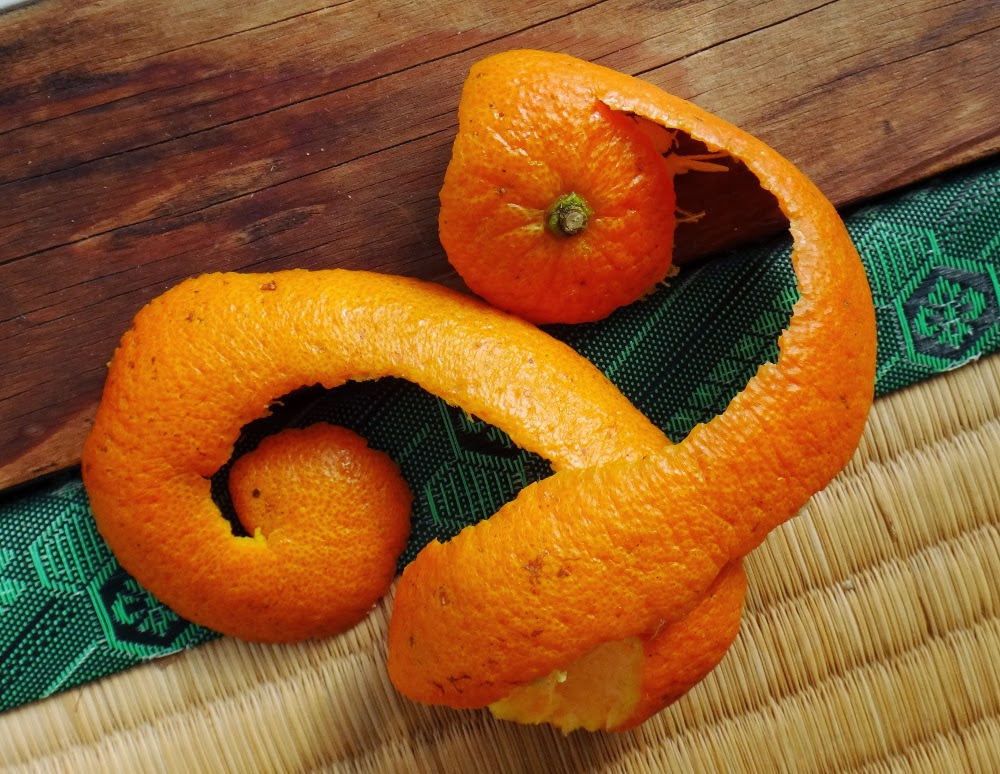
"Correctly" peeled tankan rhind.
You can find two strains of tankans in Yakushima, although few people could identify them at a glance. There is the zairai, or heirloom, variety, and the selectively bred Tarumi #1. The zairais hit the market well before the warmth of spring has come. They have an intense flavor that I love, but many people are turned off by the abundant seeds. The Tarumi #1 is sweeter, usually bigger, easier to eat, and has very few seeds.


But even within each strain, there is a lot of variation depending on growing conditions. I asked a grower at the end-of-harvest dinner about this and learned the following: Fruits growing near the bottom of the tree tend to have more nutrients, and therefore have more concentrated qualities, while those too near the top may be watery, or have a big, bubbly appearance. Later, while trying my hand at fruit QC, I learned that the vibrant orange color depends on exposure to direct sunlight, and those growing in the partial shade of a leaf or two develop a nice gold-to-orange two tone skin. Flavor and nutrition content also depend on exposure to sunlight.


So if sunlight is good, what's the deal with all those socks? Hehe. Those covers are meant to keep the  brown-eared bulbuls from pecking holes in all the fruits. I don't know if it works or not, and not everybody uses them, but they sure look cute!


I should also mention Yakushima's other big citrus export, ponkan tangerines, which have been grown in Yakushima for 90 years. If the Tarumi #1's aren't mellow enough for you, then ponkans, harvested in December through January may fit the bill.


And finally, how to eat a tankan: It's hard to go wrong, but the general opinion is that it's easiest to peel it from the bottom and work around in a circle like you would peel an apple.


Saturday, February 1, 2014

Sanbon Sugi gets a physical.

If you've been following my blog, you may know that visitors can no longer see Jomon Sugi from the "front," because a health exam a little over a year ago found that the overhanging limb is hollow -- as it may have been for hundreds of years -- and was deemed hazardous to those standing below. But just how do you go about evaluating the health of a tree that's older than Jesus?

This January, I went to the local Forestry office and asked. Fully expecting to be shown a stack of papers and research reports, I was thrilled by the answer:
Why don't you come along and see for yourself?
平成24年11月、縄文杉の正面の枝が空洞だ(←たぶん大昔から)とわかって、下の展望デッキに立っている登山者の安全を確保するため、林野局の判断に従って、展望デッキの半分が立入禁止となった、とごご存じでしょうか。でも、縄文時代から生きてきたものの場合、健康診断はどうやって行われているでしょうか。林野局の保全センターに聞いてみたら、その答えは、
 調査結果を読んでもいいけど、その代わりに、今度、見学に行ったら?

The Patient: Sanbon Sugi
The next examination coming up was for a tree named 三本杉 -- Sanbon Sugi, or, literally, Three Sugi Trees, in English. This tree isn't on the list of milleniarians, but, according to the head of the research team, it received its name well before any of its famous Yakusugi associates. Not only does this threesome of inosculated (I'm impressed if you don't have to google inosculation!) trees stand along the
That's a bottle of
Mitake shochu behind
the inscribed stone.
Kusukawa Trail used by Edo-period loggers to access Yakushima's interior, but it's a holy tree. In fact, there is a small shrine recognizable by the carved stone nestled among the trunks. Over hundreds of years, the tree has grown up around this stone, so that the dedication is only partly visible.

次の調査の対象は三本杉でした。まだ屋久杉と呼ぶほど古くない杉ですが、現在屋久島の他の著名杉の名前が決まった断然前に、この不思議な杉は三本杉と名づけられました。三本の大きな杉が合体してるかたちで、江戸時代にも伐採のために使われた楠川歩道に立っています。数百年渡って、幹と幹の間においてある碑の字を二つしか見えないほど木が成長しています。

Sanbon Sugi, measurement sticks
in place.
Once there, the head scientist bowed to the shrine, and then they set up tools for standard measurements, laying out tape measures and standing a ten-meter-high pole next to one of the trunks. We all backed away and tried to estimate the height of the tree -- not an easy feat in a dense forest. I counted out 24 meters to a space where I could see both the top and bottom of the tree, and then took out my cell phone (got to love smartphone apps!) to measure the angle. Others estimated how many ten-meter poles would be required to reach the top. The team leader, a local well-versed in both about nature and local lore, took out a surveying device that looked a bit like a mini-telescope that measured both and angles to calculate height. Most estimates fell around 24 meters, although both my cellphone and the surveying device gave something closer to 30m. The leader jotted down the height and environmental conditions and sketched the tree on the long form he carried.

班長がお参りをしてから、研究者達はメジャーなどを広げたり立てたり、様子を確認しました。そうして、皆さん、三本杉から下がって樹高を推測しようとしました。木々が密生している森の中には、大した技です。10メートルの棒を水準にして推測したり私は携帯のアプリを使って、角度と距離で推算しました。班長はそれを自動的に図って計算する装置を出してが、意外に高い数字(約30m)が出ました。(目で推測すろと、24mぐらいではないかと思っていました。)
Circumference is measured at the highest point 1.3 m above the ground.


Coins removed and returned
to the shrine. Did you know one-yen contain aluminum, which is bad for the environment?


Soil Observations: Testing the firmness of the soil. Note the book of swatches on the ground.
The next measurement was circumference (and thereby diameter) of each trunk. This is measured at 1.3 meters from the ground, so that the sprawling roots don't overblow the measurements. Then parameter of the roots. What trees (epiphytes) had taken up root on Sanbon Sugi. (It's not easy to identify a plant that's 12 meters up the side of another tree trunk!) and what plant species were growing in the area. The depth of hollow openings above the roots. A sound-test for hollowness. (All three trunks are hollow.) Estimating how far the branches extend in all directions. The presence of fungus on decaying limbs. (The form called for identification of the fungus, which is something I couldn't do with the fungus in front of my nose, and this fungus was probably 15 meters above. サルノコシカケ, polyporaceae, seemed like a good bet.) Things like that.

次は各幹の胸高周囲(地面から1.3mの高さで周囲を図る)、根っこの周囲、着生植物の種類(難しい!)、付近に生えている植物、空洞状態のテスト(各幹、皆空洞です。)、枝の延長、菌類の有無と週類。(感動しますは。菌類のわからない私は、十数メートル頭上の菌類の種類の判断は無理です。サルノコシカケかな。)などなど。

Lunchtime was the most interesting for me. I'd racked up a bunch of questions I wanted to ask, but found it was much more interesting to let the group talk about things I hadn't even considered.

昼ご飯の会話もかなり面白かったです。いろんな聞きたい質問がありましたが、皆さんの話しが面白すぎて、ほとんど聞き忘れました。特に班長は自然についても里についても詳しいです。

In the afternoon we started the soil measurements, which take the most time. A couple holes were dug and the leader expertly documented the soil layers including color, granularity, stiffness, and a bunch of other factors I didn't understand. Apparently these things have been recorded for soils all over Japan, and you can look up the color in this little booklet that must be the world's most expensive book of swatches (to untrained eyes, just like you get for free from the paint store!) to find out the stage of erosion. While the leader concentrated on that the rest of the team took turns boring meter-deep holes by dropping a weight on the end of a sharp-tipped pipe. With each drop, the pole sank a few milleters or maybe even a couple centimeters, and the depth was recorded. The weather forecast had called for partly cloudy skies, but it was much chillier than most of us had anticipated, and I found myself cheering for the pole to sink faster as a shivered and waited.

午後になったら地質を調べました。結構時間がかかりました。穴を掘って、土壌の色、硬さ、粒子の大きさ、などなど。日本の各地でこれらがすでに研究されているため、(めちゃくちゃ高い)本で色を検索したら、土壌の腐食度合いを調べられるらしいです。班長が詳しい観察を行いながら、残りは重りの付けられている棒で4つの穴を作って、土壌貫入式を行いました。重さを上げて、落とす度に棒が少しずつ地面に入り込んで行きます。その深さを記録しながら1mの深さまで繰り返す作業です。天気予報は晴時々雲でしたが、とっても寒かったです。その土壌貫入式棒を見つめながら手が震え始めそうになりました。

While the team was documenting all the flora in the area, (omg, they're supposed to know the names of all those ferns?? Wow.) a family of monkeys -- apparently aquaintances of our leader -- stopped by to chat as they foraged nearby.

研究者達が植物の種類の記録していた時、(皆さんはとても詳しいです。特にシダの区別が難しそうです!)数匹のサルたちがよってきました。班長の知りたいみたいに、遊び声をかけたり、うちたちが研究作業に励みながら、サルたちは採食行動に励んで、面白かったです。


Sanbon Sugi (according to Yakusugi Museum texts)
Height: 23.4m
Circumference (of largest trunk): 4.9m
Elevation: 550m

Special thanks to the kind and knowledgeable folks in the forestry office and at the Yakushima Forestry Conservation Center.

林野局や屋久島森林生態系保全センタの方々にとても感謝しています。

Saturday, August 10, 2013

Ja no Guchi Waterfall

Just a bit further. . .
It was September of 2009 when I first got on the Jetfoil to Yakushima with a bunch of curry packets, a tent, and a jacket stuffed into my bag and not a clue as to what I was doing. On the way to my seat, I picked up the largest brochure with a map of Yakushima, and the first thing to catch my eye was the Ja no Guchi waterfall.

Blanaphors:
Parasitic plants commonly
seen in autumn.
The hike to Ja no Guchi shares none of the fame of Shiratani's moss forests or Mt. Miyanoura's sub-alpine grandeur, but it has some good points. For one, there's no big steep elevation change, so if you've already hiked a big one, and you're looking for a low-key day for recovery, this route may fit the bill. Oh, you'll still want your hiking boots: You might even miss Jomon Sugi's staircases and boardwalks when you have to scramble over boulders at the brook adjacent to the waterfall, and there's a detour along the way that takes you over a small hill where you'll probably use your hands to pull yourself up and ease yourself down.

Onoaida Onsen
Another highlight is Onoaida Onsen, just next to the trailhead. For ¥200 you can enjoy this hot spring favored by many locals.

Charcoal making:
Wood is left in the kiln for ten days.
The forest through which the trail winds is a great example of the low-altitude broadleaf evergreen forests Yakushima's inhabitants have traditionally depended on for their daily needs. You'll even pass an old charcoal kiln. Keep your eyes open, and you may spot plants including orchids and balanaphors. There are also quite a few streams along the way, but don't expect them to be as pristine as water bubbling up in Yakushima's mountainous interior. The trail is a bit unclear in places where it has been eroded by typhoons or where trees have fallen down, so you'll also want to keep your eyes on those pink tape ribbons so you don't get lost!

When you get to the open shelter at the fork, make sure to turn left instead of heading up into the mountainous interior. No matter what the Lonely Planet says, that's a long, long hike better attempted in the reverse direction. Needless to say, that's exactly the route I decided to do on my first oh-so-clueless visit to Yakushima, and while I had a good time and I came out alive, I highly encourage everyone to plan a little bit better than me.

After the fork, there are a couple beautiful little river that you'll cross. (Oh yeah I wouldn't recommend this trail in bad weather, because you'll have to turn back if they are overflowing.)


And shortly after that you'll reach the destination. Hopefully you've brought lunch!


Final Elevation: ~500m

Trail Head Elevation: ~100m
Map time: 3.5 hours (About 7.5 km) round trip. I recommend 4 hours for this trip.
Bus stop: Onoaida (Follow the signs to Onoaida Onsen)


View Ja no Guchi Waterfall in a larger map

Friday, July 12, 2013

Exterior Peak # 4: Tachuu Dake

You just couldn't ask for a better monolith
than Tachuu Dake's 40 m celestial pillar.
"You don't have a rain jacket?" the young man on my left asked. There were four of us huddled under the open shelter where the route to Tachuu Dake branches off from Yakusugiland's 150-minute course.

"I've been up several times, and every time—regardless of the weather forecast—it's rained. You get used to it." I explained, "Actually, I have to wear proper rain gear when I'm working, so it's a bit of a luxury to get a little wet." And maybe if I believe it will be sunny, it will be sunny. . . right.

The couple across from us dissented. They were from Okinawa, and they knew all about rain, but preferred to stay warm and dry. After all, it's a six hour round trip.

「雨具は持っていないのですか?」隣の若い男が聞きました。私、彼、そうして沖縄から来た夫婦が太忠岳の別れで雨宿りをしていました。


A map of Yakushima, as folks
living in Anbo see it.
「私は時々この山を登っていますが、天気予報と関係なく、毎回雨になっています。だから慣れています。実はガイドの仕事をする時、必ずちゃんとした雨具を着るので、たまに雨に濡れるのは贅沢な感じです。

沖縄の二人は雨に慣れているけど、濡れないほうが好きって。だって、太忠岳は往復5か6時間がかかるでしょう。

Tachuu Dake is easily recognizable by the large flame-shaped pier on top. This natural obelisk stands 40 m tall (according to several websites) and is visible from the town of Anbo. It speaks of Yakushima's origins as a bubble of granite that continues to rise up (1 mm every year!) as the top layers of sediment are worn away.

The celestial pillar and natural altar make Tachuu Dake an obvious destination for those seeking a spiritual journey, but the hike is also popular among hikers seeking a shorter, less crowded route than the hike to Mt. Miyanoura or Jomon Sugi.

太忠岳の山頂には安房の集落からも見える高さ40m(??)の天柱石があります。このろうそくの形になった岩はもちろん自然です。屋久島は火山ではなく、今でも浮き上がっている(年に約1mmの速さで)花崗岩のかたまりですからこそこういう不思議な岩が現ります。

スピリツアル面を探している観光客はもちろん、そうして宮之浦岳や縄文杉のルートに比べて人の少ないかつ短いコースがお好みの観光客にも人気があります。

Tachuu Dake is one of the traditional destinations visited on an annual pilgrimage from Anbo. Now, living in Anbo where I can see the celestial pillar, I know it's quite often, perhaps even usually, clear at the top of Tachuu Dake, but it wasn't until this past March, when I climbed it with my boyfriend, that I was finally greeted with sunshine at the peak.


Don't forget to enjoy
Yakusugiland on the way!
Entrance to Yakusugiland.
That's Tachuu Dake on the right.
太忠岳は、私の住んでいる安房の集落の前岳の一つであり、岳参りの習慣があります。安房から太忠岳の山頂にある天柱石が見えますので、山頂が曇っていない日は十分あるとわかっています。でも、今年の三月、彼氏と一緒に登った時、始めて晴れの天気で頂上に辿り着きました。

The route to Tachuu Dake begins in Yakusugiland, where you'll find a building with restrooms, a payphone, a souvenir shop, and an area where visitors can sit and eat lunch before entering the park. The entrance fee is ¥300, and you'll receive a brochure (English available) and postcard. Bring a small water bottle to fill from brooks along the way.


Just follow the signs to the
Tachuu Dake fork.
The snake-likeroots of fallen
Jamon Sugi.
Once inside Yakusugiland, you'll follow the 150-minute course around to the back of the park. Beside Yaku-sugi trees, you'll also pass stumps left over from Edo logging as you head through a mossy forest thick with spruce and fir trees and over a beautiful tributary of the Anbo River. Just before the fork to Tachuu Dake you'll see the roots of JamonSugi (Snake-Crest Sugi), which fell over in a typhoon about 15 years ago, and an open shelter with signs depicting local wildlife.


Shiratani isn't the only place with moss!
コースはヤクスギランドの奥に始まります。ランドの入り口の近くに大きなビルがあって、そこにはトイレ、公衆電話、お土産屋さん、雨宿りして食事ができる場所もあります。協力金の300円を払って、パンフレットとハガキを貰います。
ヤクスギランドの150分コースを辿りながら、屋久杉はもちろん、モミとツガの多い苔むしている森を歩いて、江戸時代から廃棄された株や土埋木も見えます。綺麗な川(安房川に支流)を渡る橋もあります。太忠岳の別れの直前には、蛇紋杉の根っこ(屋久15年前の台風に倒れました。)と雨宿りできる小さなシェルターがあります。

Bring a disposable toilet pack
if you want to use the only
toilet on the trail!
         
A grand evergreen forest!

Time for a drink!


The trail through Akahoya
is a bit washed out.
The next stop is Tenmon no Mori, a survey forest where you can sit or lay down on the benches and listen to the bird song. Look for a large sugi shortly after. This is Shaka Sugi. From here, the path gets rougher, steeper, and also muddier as you climb. There are one or two places where the red soil (Called Akahoya, this is the pyroclastic flow from a nearby volcanic eruption 7,300 years ago. ) is washed away and you'll have to use exposed roots to pull yourself up, but the trail is well marked and not highly prone to flooding.


天文の森というところで野鳥の鳴き声を聞き鬼界カルデラの火砕流です。)それでも、ピンクリボンや看板がありますので、迷いにくい道ですし、雨でも水没することはほとんどないでしょう。
ながら休憩ぢます。そうして釈迦杉との挨拶。山道がどんどん険しくなって、たまにドロドロです。アカホヤを通るところは、道がちょっと崩れていますので、手足を使って、根っこを握りながら登ります。(アカホヤは7300年前爆発した

A few more steps. . .
I know you'll be tempted to
gawk at the celestial pillar,
but please watch your step
 when you climb that rope!
 After Tenmon no Mori and Shaka Sugi, you won't find any obvious resting points other than a huge boulder, which you will walk around one kilometer from the peak. When you reach the peak, you'll approach the celestial pillar from the back and the forest will abruptly give way to rocks. You'll carefully scramble down a short rocky drop, walk around to the front of the "alter" and climb up a rope to stand in front of the celestial pillar for a spectacular view.

. . . and you can finally relax and eat
lunch or find religion.
That lake in the distance marks
the dam where Yakushima gets its
electricity.
天文の森と釈迦杉の後、ちゃんとした休憩場はありませんが、1キロぐらいが残っているところには大きな岩があって、そこでよく休憩しています。そうして頑張って、いよいよ山頂についたら、天柱石の後ろからアプローチします。突然、石が多くて、気をつけながら前に歩いて、ロープを使って、天柱石の前の岩を登ります。景色はすごいですよ!

ここから、ヤクスギランドの入り口のビル、安房川のダム湖、雲はなければ安房の集落まで見えます。残念ながら、宮之浦岳などの奥岳は見えませんし、天柱石は登れませんが、その手前の岩から下りて、また後ろに歩いてみたら、祠があって、お参りできます。神聖的な経験になりそうではないですか?

The hokora behind the
celestial pillar.
From here you can see the park entrance, the reservoir behind the damn on the Anbo River, and the town of Anbo in the distance. Unfortunately, there's not a view of the Interior Mountains, and you can't climb on top of the celestial pillar itself, but if you climb down from the alter and continue to walk around to the far side of the pillar, you will find the small shrine, called a hokora.

Assuming the rain gods have been kind, I'll leave you alone now for a siesta. . . or to contemplate your newly found religion. . .


Peak Elevation:1497m
Trail Head Elevation: ~960m
Map time: 5~8 hours (About 7 km) round trip
Bus stop: Yakusugiland


ViewTachuu Dake  in a larger map


Okay, this has little to do with the hike, but. . .
Something I once saw on the way.
Anybody know what the heck
this is??